Riverkeeper Community Monitoring App
Python | Streamlit | GeoJSON | Environmental Tech
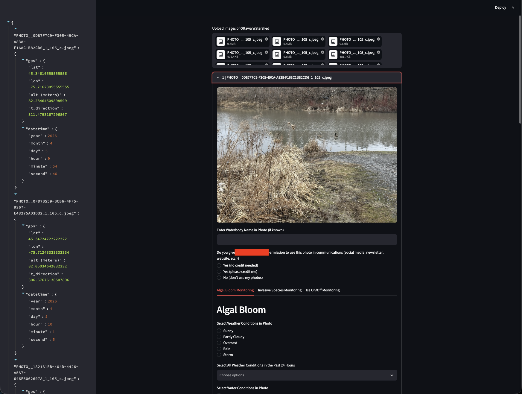
Overview
-
Inspired by UN SDG 6 public data gathering efforts, this tool bridges the gap between organizational reporting standards and end-user field convenience. Built as a lightweight Streamlit web application, it streamlines batch photo uploads and field observations for environmental monitoring.
-
By decoupling end-user data collection from rigid database schemas, it allows volunteers to quickly process media while generating standardized, schema-compliant outputs.
Core Features
-
Metadata
Extracts EXIF GPS coordinates (latitude, longitude, altitude) and exact timestamps directly from uploaded photos.
-
Geospatial
Uses pygeomag to calculate magnetic declination and true camera direction.
-
Media
Handles multiple image formats (JPG, PNG, TIFF, DNG) with automatic orientation fixes and DNG raw processing.
-
Inputs
Provides structured forms for Algal Bloom, Invasive Species coverage, Ice On/Off conditions, and environmental factors.
-
Outputs
Generates human-readable JSON preview data alongside standard GeoJSON FeatureCollections for direct integration into Esri feature layers or database endpoints.